We have much more to do and your continued support is needed now more than ever.
Exploring the Missisquoi River – What’s at Stake from a Tar Sands Spill in Vermont?
This tree-lined sanctuary sits at the end of the Missisquoi River’s winding path through northern Vermont, and it’s a vital feeding, nesting and resting habitat for many different types of wildlife that can be found in smaller numbers throughout the state. It’s also one of many areas that would be threatened by a break in an aging oil pipeline that cuts through Vermont, and which could be used to transport a type of heavy crude oil that is nearly impossible to clean up.
Birds and fish of the Missisquoi River – and Vermont
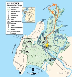
Just a few hundred feet downstream from the highway, a Great Blue Heron – the iconic creature of the refuge – watched us paddle close before opening his wide blue-grey wings, slowly flapped a few feet above the marsh grass, and settled on a branch farther away. Several more herons made appearances throughout the afternoon, but none let us get as close as this one did. And the graceful white egrets standing miles farther into the refuge were the least willing to be photographed of all.
After an easy float with the current out to the bay, we drifted around the outside of Shad Island, which is one of the region’s most important and productive Great Blue Heron rookeries. In the spring, the young birds are so loud you can barely hear anything else. Today, it was quiet. A screech prompted us to look up, in time to see an osprey carrying a fish in its claws, over our heads and high into the trees. Osprey are relatively common in the area, fishing in the choppier waters of the lake and nesting in trees throughout the refuge.
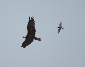
Paddling back through the dark, still waters in the central channel of the refuge, we saw a fish jump every few minutes. A huge, spotted brown bird of prey saw them too – body too big to be a heron, huge wingspan, mottled coat, most likely a red-shouldered hawk – which swooped in and out of the trees waiting for the right moment to grab one. Bald eagles also nest in the refuge from time to time, but we weren’t lucky enough to spot an eagle.
Of the dozens of birds common to the refuge, we did see sparrows, wood ducks, a group of double-crested cormorants, common terns, and a belted kingfisher.
A reminder of what’s at stake
Unfortunately, all of these birds, fish and other residents of the refuge would feel the adverse effects of an oil spill. A break in the WWII-era pipeline where it crosses the Missisquoi, or a problem at the pumping station just over the border in Quebec, could cause oil to spill – and the company that operates the pipeline admits that the oil could make it this far. If the pipeline were being used to transport tar sands oil – a thick, heavy, sticky substance that sinks to the bottom of rivers and has proven nearly impossible to clean up – the impact would be much worse.
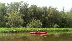
Residents and neighbors of the area near where the pipeline crosses through Vermont in the Northeast Kingdom have been coming together over the threat to their waters and local wildlife. The threat extends many miles beyond the postcard-perfect spot where the pipeline itself crosses under the covered bridge in North Troy: It reaches into the darkest inlets of the wildlife refuge nearly 40 miles away. Getting out on the water in person to marvel at just how tall a heron really is, or how high fish can jump, reminds us exactly what’s at stake when we make decisions that involve risks to our water, land and air. Vermont’s wildlife habitat is priceless, and we owe it to future generations of noisy young blue herons – and the people who love them – to protect it.
Take Action for Wildlife
![]() Help keep moose in the Northeast safe from tar sands. Tell your governor to say “No” to tar sands.
Help keep moose in the Northeast safe from tar sands. Tell your governor to say “No” to tar sands.


