


We have much more to do and your continued support is needed now more than ever.
Mapping Invisible Barriers: A Frontier in Conservation
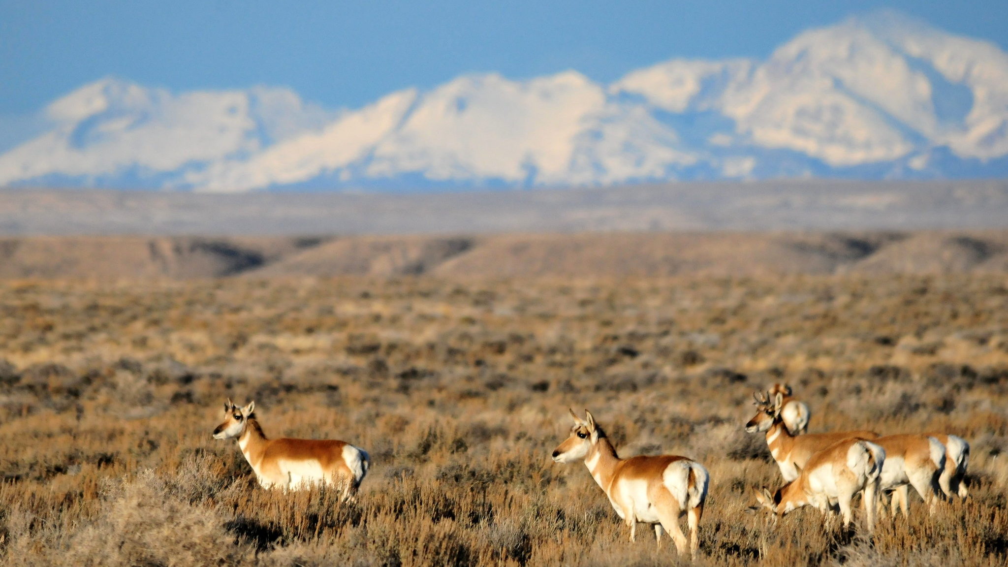
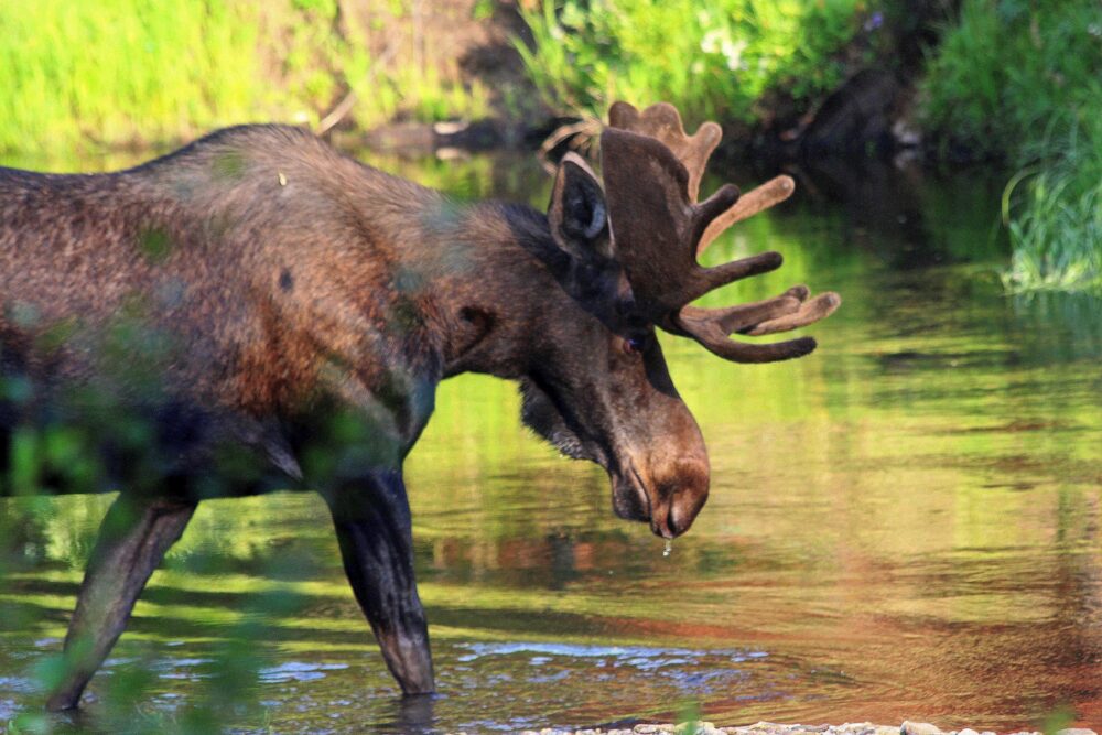
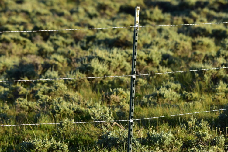
The presence of fences impacts large mammals and their migration paths like the pronghorn antelope pictured here in Wyoming. Photo by Tom Koerner/USFWS.
Humans have impacted and altered landscapes in enumerable ways, but fencing is a significant aspect of our collective footprint that is often overlooked. Fences are so common across the globe that most of the time we don’t even notice them. In many rural areas, there are now more fences than roads. However, just like most things we build, there are unintended consequences to proliferating fencing across the landscape.
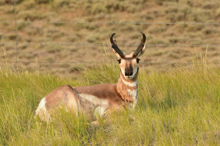
Fences are used for various reasons worldwide and scientists are just beginning to understand their complex ecological impacts. If you’ve ever visited the vast swath of prairie in the American or Canadian West, maybe you’ve seen a pronghorn antelope prodding the bottom strand of a barbed-wire fence looking for a way under because—unlike deer and elk—they rarely jump fences. This creates a big problem for pronghorn in the winter, when snowdrifts can make it difficult to crawl under fences.
With that image comes an idea: the animal could pass through if we just removed the bottom strand of fence wire. The ability of wild animals to “pass-through” is ever more important as habitats continue to be degraded and fragmented around the world. Our best shot at maintaining biodiversity on a rapidly changing planet is to conserve protected areas and the lands and waters that connect them. In many areas, we can build fences in a manner that reduces their unintended consequences while still doing their job.
Building a wildlife-friendly fence is often a win-win solution for landowners and wildlife. A fence that allows passage for large mammals like pronghorn, deer, elk, and moose is less likely to get broken and battered as these animals seasonally traverse the matrix of private and public lands to find resources. A more permeable fence can save landowners money in the long run and help sustain populations of big game by aiding migrations.
Make no mistake, these types of solutions that benefit both wildlife and people are elusive. Moreover, in the face of so many environmental problems, from climate change to plastics pollution to deforestation, it often feels like one person’s actions make little difference. However, modifying a fence to allow wildlife passage has immediate, concrete, tangible gains.
One moment, an animal’s path is blocked. The next moment, the barrier is removed and the animal passes through.
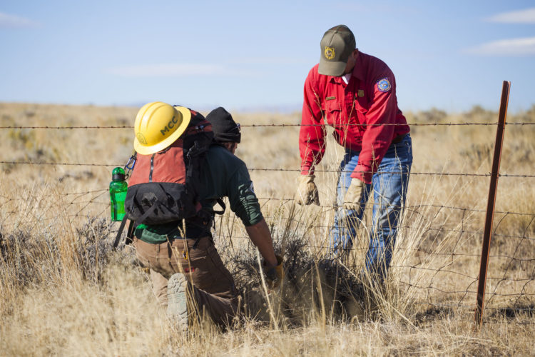
This is not to say that removing fences will solve all our problems. It is important to acknowledge that wildlife can damage crops and potentially transmit diseases to domestic livestock, thus adding economic burdens to farmers and ranchers. However, for all the hundreds of thousands of miles of fences that are out there, surely there is a great opportunity to build partnerships to modify or remove fences where warranted. We need a targeted approach, a way to pinpoint areas to focus our resources to have the biggest impact on conservation.
Our first step begins with a series of questions: Where are fences located and what types of fences are they? Answering these questions will then help design research to understand how fences impact wildlife populations and ecosystem processes. Figuring out where fences are and what types they are, it turns out, is a bigger challenge than it sounds. Even though fences are ubiquitous, they are a network that is decades upon decades in the making, and it is a near-impossible task to track them all. Even geographic information system (GIS) layers, which outline roads, canals, buildings, pipelines, and green spaces, have yet to cover fences.
I saw an opportunity to build fence maps to help answer some of these questions. My first approach combined geographic layers to predict fence locations and densities in a model, and my second approach used satellite imagery to map individual fences. The model included spatial data, such as land ownership boundaries, roads, and vegetation type. Then I interviewed natural resource professionals to generate a list of assumptions about how these layers interact to predict fence locations. This approach did a good job of estimating fence density across the landscape, but it wasn’t very accurate for pinpointing individual fence locations.
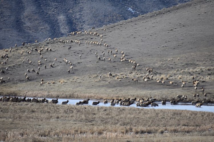
Not all fences are created equal in terms of their impact on wildlife movement. For large herbivores, it likely only takes one impenetrable fence (one that can’t be crawled under or jumped over) to block a migration route, even in an area of otherwise low fence density. So, to identify individual fences, I started looking at satellite imagery and tracing fence lines by hand in Google Earth. This was a daunting task—and time-intensive—but it proved to be highly accurate in non-forested areas. The individual fences that were the greatest barriers popped right out of the screen as soon as we added pronghorn GPS movement data to this hand-digitized map.
The visual impact was not only stunning, but it was also highly informative. We could see pronghorn backtracking miles to find a crossing site through a fence and continue their southward journey to Yellowstone. In one case, the map revealed how some pronghorn were trapped within a pasture and walked around in circles for weeks until they found a way out. When we completed a ground survey, we found that most of these fences had bottom wires only inches from the ground.
Using large-scale fence density mapping, biologists can now examine how wildlife populations are responding to fences across their seasonal ranges. By pairing the density model with imagery mapping, we can identify individual fences for modification or removal. Once the fences have been identified, the next step is to collaborate with landowners, natural resource agencies, and other interested parties to coordinate resources and get to work. Ultimately, together, we can keep our wildlife on the move.
Simon Buzzard is an ecologist working to maintain biodiversity by building partnerships that benefit wildlife and people.
