We have much more to do and your continued support is needed now more than ever.
How Do We Know Anything About Migrating Birds?
What is Aeroecology?
Each August, billions of birds rally themselves for the long, dangerous migration south. With the abundant foods offered by the summer breeding season now dwindling in supply, these animals must face an exhausting long-haul flight to warmer—and safer—lands. Some species, like the striking cedar waxwing, might only move a few hundred miles; others, like the arctic tern, could cover over 55,000 miles in just a month and a half.
Regardless of the distances they may travel, all migratory birds must utilize a very strange and enigmatic ecosystem—the air itself. This ecosystem, called the aerosphere, can be thought of much like any other habitat. It has its own set of unique climate conditions, physical structures, evolutionary pressures, and threats.

Life in the air can be challenging. In contrast to animals that spend their entire lives on the ground or in water, creatures that use the aerosphere are almost immediately affected by sensitive changes in such things as precipitation, temperature, sunlight, moonlight, air density, and wind. For example, wind intensity over the Caribbean Sea, Atlantic Ocean, and Gulf of Mexico considerably affect where and how often birds choose to stop and rest during migration, which can drastically alter their chances of surviving the journey. For many species, migration is simply the deadliest part of life.
Aeroecology is the study of how airborne organisms use the aerosphere. Studying the way that animals respond to and take advantage of the dynamic habitat of the sky is important for understanding the evolution, ecology, and conservation of many species, but because human researchers cannot fly, aeroecological data has been notoriously difficult to collect in the past.
As fall migration begins, we at the National Wildlife Federation would like to take the opportunity to explore how new advancements in radar technology have allowed researchers to monitor migration with more clarity than ever before. How has the field of aeroecology revolutionized migrant conservation? And more importantly, how can every one of us can help make migration safer for millions of birds this fall season?
NEXRAD: An Old Tool for a New Purpose
The majority of birds migrate at night, making traditional sight-based estimates of migration particularly unreliable. To get around this, aeroecologists now rely on remote sensing technologies that do not require sight in the first place, like radar, thermal imaging, and acoustics, to study organisms in a habitat that humans cannot normally reach.
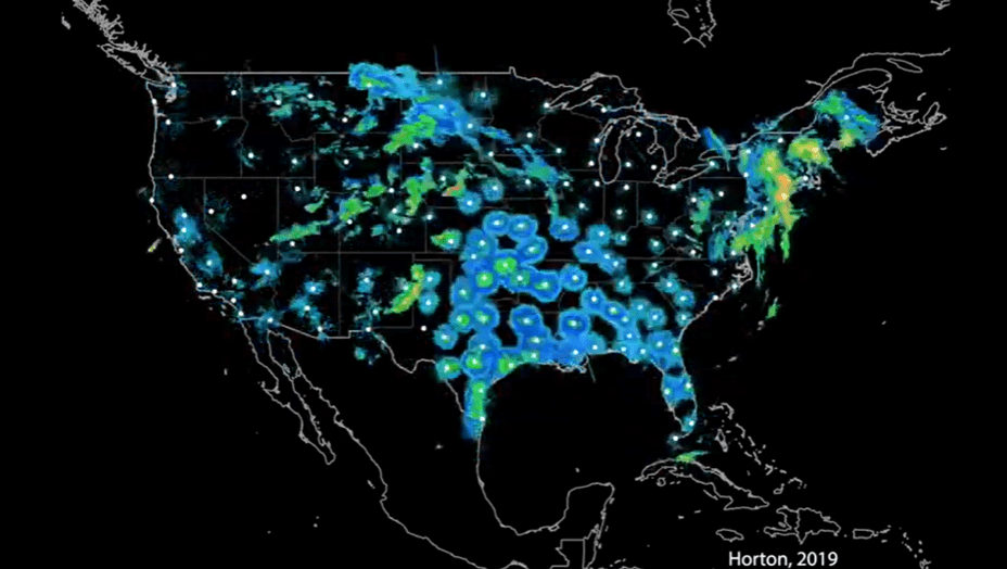
Radar technology is especially helpful for tracking migration routes, avian flight traffic, and stop-over rest sites. Although the United States initially installed NEXRAD (next generation radar) in 1988 as a way to monitor weather, scientists have found that these machines are also potent tools for detecting large masses of migrating birds.
The U.S. currently maintains 143 weather surveillance radars which are used openly for aeroecological research, and these large data sets have provided valuable insight into the mysteries of migration. Recently, 24 years-worth of data amounting to over 13 million weather radar scans have shown definitively that warming temperatures associated with climate change correlate to the phenomenon of birds leaving for migration progressively earlier in the year.
The NEXRAD network was overhauled in 2013, which added new ways to detect activity in the aeroscape, and this upgrade has already proved to be invaluable for informing conservation initiatives. Just this year, researchers used the NEXRAD system to show that one-third of nocturnal migrants in the Great Lakes area fly through airspace with high densities of wind turbines. Radar data has already been used to create predictable opportunities to help minimize the impact of wind energy development on migrant birds in this area.
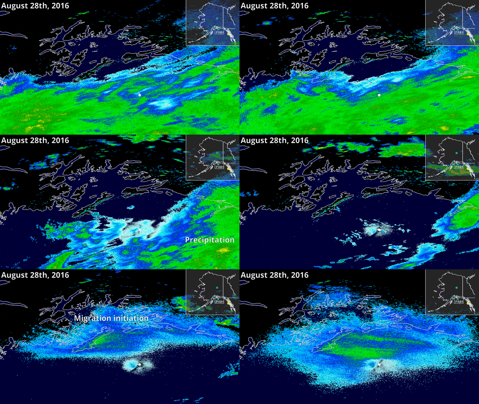
These upgrades have also allowed for the exploration of migration activity in the previously uninvestigated area of Alaska, where animal populations encounter the most rapid effects of climate change. In 2021 researchers led by a high school student used 400,000 NEXRAD radar scans to measure spring migration intensity, timing, and directionality in North America’s most vulnerable region for the first time, greatly improving our understanding of Alaska’s migrant birds.
Birdcast: A New Tool for an Old Purpose
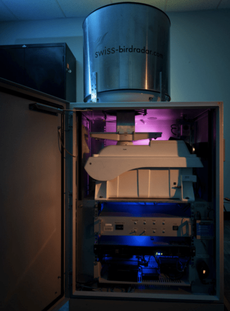
Colorado State University’s Aeroecology Lab has been at the forefront of radar investigation for many years and is responsible for much of what we know about large-scale avian migration today. The lab has worked with Cornell University to create an exciting new tool for an age-old hobby—birdwatching.
Birdcast, launched in August, is a free-to-use tool that forecasts nightly bird migrations across the country much like a weather forecast map. These forecasts show the predicted timing and amount of bird migration overhead for the coming three nights. The tool includes a live migration map as well as an opportunity to search for your city’s forecast.
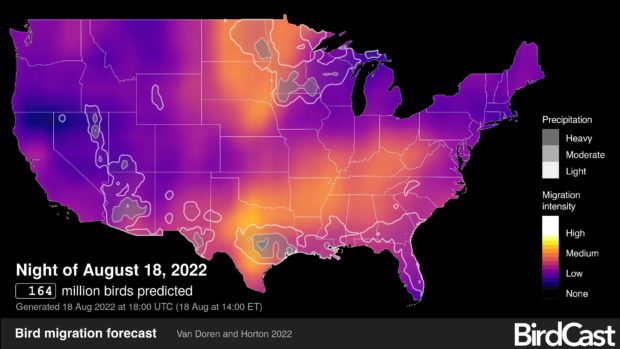
Remember that Birdcast is a predictive tool, just like a weather forecast. High-intensity nocturnal migration does not guarantee a great day of birding; instead, it means that a large number of birds is predicted to migrate through the area that night!
Lights Out Alert: A New Tool for a New Purpose
Recently, radar aeroecology has been especially helpful for determining how light pollution affects migrating birds. Lights attract and disorient birds, making them confused and vulnerable to collisions with buildings. Radar data have shown that an estimated 1 billion birds die in collision with buildings every year.
In 2017, the floodlights of a single 23-story building in Texas disoriented and killed 400 birds in just one night. We now know that turning off unnecessary lighting can greatly reduce collision risk for these birds.

Created in 1993, FLAP (Fatal Lights Awareness Program) in Ontario was the first group to raise awareness about this problem. Audubon created the Lights Out Program in the U.S. shortly after, and since then more than 30 cities have joined the Lights Out Network across the U.S. These cities have committed to reducing the impact of city lights during peak migration season. You can see if your city participates here.
New radar data has shown that ideal conditions causing extremely high rates of migration through a city happen rarely, with 50% of birds passing by on just 10% of seasonal nights. That translates to a very reachable goal: turning off unnecessary outdoor lighting in these areas for just 9 nights per season can greatly reduce the risk to about half of all North American migrant birds.
In addition to Birdcast, CSU’s Aeroecology Lab provides a Lights Out Alert tool to identify where migration intensity is highest in heavily-lit areas. These provide state-wide maps showing where turning off lights can be most helpful for birds.
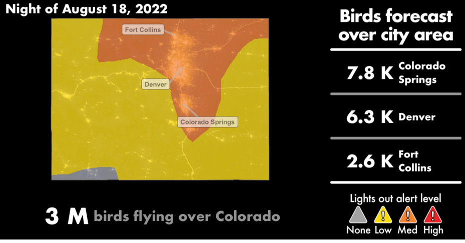
We can all do our part to help migrant birds by joining the Lights Out initiative. Now, with the help of NEXRAD and the brilliant scientists who use it, every American has the tools to do their part. If this tool indicates that your city is in red alert, you can help migrant birds by:
- Turning off exterior decorative lights,
- Extinguishing pot and floodlights,
- Reducing atrium lighting,
- Turning off all lighting in higher stories, and
- Down-shielding exterior lights to reduce window glare.
We live in an incredible era of technology; an era where over a hundred machines can see into the darkness above, and see the truth in the mysteries of migration when humans cannot. By embracing these new tools, we can all help to pave the way for a brighter (or should we say, darker?) future for our wonderful migrant birds.

